
Претраживање
Приказ резултата 31-40 од 60
Using Geodesign Studio to Explore Alternative Local Spatial Development Scenarios in Serbia
(Springer, Cham, 2022)
Sustainable Developments Goals (SDGs) in Serbia are reduced to the pursuit of economic growth and spatial planning in local areas is reduced to a governance mechanism for attracting investment. Similarly, if existing, ...
Snow Avalanche Hazard Prediction Using the Best-Worst Method—Case Study: The Šar Mountains, Serbia
(Springer Nature, 2023)
Snow avalanches are one of the most frequent natural hazards in high mountain regions. In this study, a map of the susceptibility of the Šar Mountains to snow avalanches was determined. The study area is located in the ...
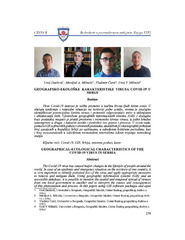
Geografsko-ekološke karakteristike virusa Covid-19 u Srbiji
(Beograd : Centar za strateška istraživanja nacionalne bezbednosti - CESNA BMeđunarodna Akademija Nauka, Umetnosti i Bezbednosti - MANUBUniverzitet "Sveti Kiril i Metodij", Veliko Trnovo, 2020)
Virus Covid-19 izazvao je velike promene u načinu života ljudi širom sveta. U slučaju epidemije i vanredne situacije na teritoriji jedne zemlje, veoma je značajno identifikovati potencijalna žarišta virusa i primeniti ...
Квалитет воде реке Пепељуше
(Александровац : Завичајни музеј Жупе, 2020)
Колико је вода значајан ресурс указује чињеница да је она одговорна за настанак, развој и одржање живота на Земљи. Услед интензивног развоја човечанства, расте и притисак на водне ресурсе и њихово загађење. Све ово доводи ...
Koncept „kreativnog“ i „uzbudljivog“ grada u razvoju gradova srednje veličine: Šabac, Sombor i Zrenjanin
(Beograd : Srpsko sociološko društvoBeograd : Institut za uporedno pravoNovi Sad : Univerzitet u Novom Sadu - Filozofski fakultet, 2015)
Rad ima za cilj da konceptualnim razumevanjem „kreativnog” i
„uzbudljivog” grada prepozna potencijale lokalnog razvoja gradova srednje
veličine: Šapca, Sombora i Zrenjanina. Navedeni gradovi predstavljaju
odabrani ...
Floods in Serbia in 2010 - case study: The kolubara and pcinja river basins
(Springer Netherlands, 2013)
Riverine and torrential floods are the most significant natural hazards on the territory of Serbia. The potentially flooded area in Serbia with a 100-year return period is 15,198.07 km2 (17.2% of total area). Serbia is ...
Biomedical Images Processing Using Maxeler DataFlow Engines
(Springer Cham, 2019)
Image segmentation is one of the most common procedures in medical imaging applications. It is also very important task in breast cancer detection. Breast cancer detection procedure based on mammography can be divided into ...
Territorial-demographic and functional оrganization of the Negotinska Krajina settlement net
(Београд : Географски институт "Јован Цвијић" САНУБеоград : Институт за новију историју СрбијеБеоград : Институт за славистику Руске академије наука, 2014)
The research results presented in the paper refer to the territorial demographic and functional organization of Negotinska krajina which is, in many ways, specific area in north-eastern Serbia. The researched area is a ...

Groundwater quality degradation in Obrenovac Municipality, Serbia
(IntechOpen, 2012)
Geomorphological Characteristics of Serbia
(Springer, Cham, 2022)
The main morphological feature in the relief of Serbia is its gradual rise from the Pannonian Plain in the north to the highest parts of the Šar-Prokletije Mountains in the south and southeast. The central part of the ...