
Search
Now showing items 1-10 of 16
Geographical information systems and remote sensing methods in the estimation of potential dew volume and its utilization in the United Arab Emirates
(Springer Nature, 2021)
In a fast growing region of Middle East and with rapid depletion of fossil groundwater, possibilities for dew utilization as a limited renewable water resource play an important role in the water management of the United ...
Multihazard susceptibility assessment: A case study – Municipality of Štrpce (Southern Serbia)
(De Gruyter Open Access, 2021)
The municipality of Štrpce (Southern Serbia) is
an area located within Šar Mountain National Park, which
is of great ecological importance. Due to the vicinity of
settlements, it is necessary to analyze the terrain's ...
Application of the geodiversity index for the assessment of geodiversity in urban areas: an example of the Belgrade city area, Serbia
(Croatian Geological Survey, Zagreb, 2016)
Considering the fact that urbanization is one of the most serious threats to geodiversity, it is important that this issue is taken into account in spatial development plans and georesource management strategies in urban ...
Designation of conservation site network in order to mitigate climate change impacts on birds: a case study of Serbia
(Parlar Scientific Publications, 2020)
This paper analyzes relations between population and conservation status of bird species that are affected by various threats, with a special emphasis on climate change on the example of the Important Bird Areas (IBAs) ...
Assessment of soil erosion potential by the usle method: case study, Republic of Srpska - BiH
(Parlar Scientific Publications (P S P), 2011)
Soil erosion is a global problem, with severe consequences for the environment, human society and economy. In most cases, this process is caused by natural forces, but some human activities also contribute to soil erosion. ...
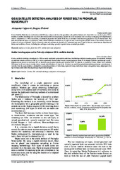
GIS & satellite detection analyses of forest belt in Prokuplje municipality
(Univ Osijek, Tech Fac, Slavonski Brod, 2016)
Corine Satellite Detection in combination with GIS may analyse and show the quantitive and qualitive features of a forest belt. As a result, it gives 100 m resolution satellite recordings and may even show horizontal forest ...
Urban Development Consequences on the Wetland Ecosystems Transformations-Case Study: Pancevacki Rit, Serbia
(Maik Nauka/Interperiodica/Springer, New York, 2018)
The article analyzes the consequences of one century long human influences on vegetation of the wetland ecosystem, on the example of Pancevacki Rit in Belgrade, Serbia. The autochthonous, non-altered ecosystem was formed ...
Assessment of soil erosion potential using rusle and GIS: a case study of Bosnia and Herzegovina
(Parlar Scientific Publications (P S P), 2013)
Soil erosion is a significant environmental problem that causes severe consequences on the human society and economy. The Integrated Revised Universal Soil Loss Equation (RUSLE) with the Geographic Information System (GIS) ...
Multi-criteria GIS analysis of the topography of the Moon and better solutions for potential landing
(Sciendo, Warsaw, 2019)
During the past twenty years, the need to reach the Moon by the private space missions has been growing. Some of the private missions are supported by Google Lunar X-prize and Space-X. In the period between 2020 and 2050 ...
GIS analysis of dissipation time of landscape in the Devil's city (Serbia)
(Berg Fac Technical Univ Kosice, Kosice, 2015)
The Devil's City is a unique geomorphological site well known regarding strangely sculptured stony pillars or soil (clayey) pyramids, abandoned mines and two rare hydrologic occurrences. The present landscape is partly ...