
Pretraživanje
Prikaz rezultata 1-4 od 4
Design and implementation of WebGIS technologies in evaluation of erosion intensity in the municipality of NIS (Serbia)
(Springer, New York, 2016)
This paper studies the estimated losses of soil by water erosion in the municipality of Nis ( Serbia). The assessment of losses is determined by USLE method integrated with GIS technology, which provides a simple and fast ...
Application of the geodiversity index for the assessment of geodiversity in urban areas: an example of the Belgrade city area, Serbia
(Croatian Geological Survey, Zagreb, 2016)
Considering the fact that urbanization is one of the most serious threats to geodiversity, it is important that this issue is taken into account in spatial development plans and georesource management strategies in urban ...
Geoecological evaluation of Belgrade and environment for the purposes of rest and recreation
(Bijeljina : Technical Institute Bijeljina, 2016)
With this work we want to affirm geoecological evaluation, planning and landscape management. Geoecological evaluation of the Belgrade region, for the purpose of rest and recreation, was performed with quantitative method ...
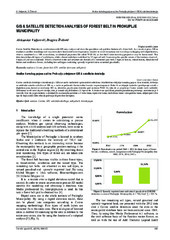
GIS & satellite detection analyses of forest belt in Prokuplje municipality
(Univ Osijek, Tech Fac, Slavonski Brod, 2016)
Corine Satellite Detection in combination with GIS may analyse and show the quantitive and qualitive features of a forest belt. As a result, it gives 100 m resolution satellite recordings and may even show horizontal forest ...