
Search
Now showing items 1-10 of 86
Assessment of torrential flood and landslide susceptibility of terrain: Case study - Mlava River Basin (Serbia) / Процена подложности терена за настанак бујичних поплава и клизишта: студија случаја - слив реке Млаве (Србија)
(Beograd : Srpsko geografsko društvo, 2021)
Torrential floods and landslides are frequent natural disasters in Serbia, but also in the Mlava River Basin. Due to the large number of settlements, the main goal of this research is to determine the locations that are ...
GIS application for the natural conditions evaluation of Ražanj municipality for agriculture purposes / Primena GIS-a u vrednovanju prirodnih potencijala opštine Ražanj za potrebe poljoprivrede
(Beograd : Srpsko geografsko društvo, 2006)
In this paper is presented an example of quantitative evaluation of natural conditions for the agriculture purposes on the territory of Ražanj municipality. With assistance of GIS application, are analyzed soil attributes ...
Geographical information systems and remote sensing methods in the estimation of potential dew volume and its utilization in the United Arab Emirates
(Springer Nature, 2021)
In a fast growing region of Middle East and with rapid depletion of fossil groundwater, possibilities for dew utilization as a limited renewable water resource play an important role in the water management of the United ...
Multihazard susceptibility assessment: A case study – Municipality of Štrpce (Southern Serbia)
(De Gruyter Open Access, 2021)
The municipality of Štrpce (Southern Serbia) is
an area located within Šar Mountain National Park, which
is of great ecological importance. Due to the vicinity of
settlements, it is necessary to analyze the terrain's ...
Analysis of Cartographic Generalization based on PYTHON Programming Language on Digital Topographic Maps
(SciTePress, 2020)
Cartographic generalization is a creative process of abstraction, which is used in the design and content preparation of topographic maps. It includes the study of the geographic environment, processing of geographic data, ...
Geoekološko vrednovanje reljefa Odorovskog polja primenom GIS-a
(Beograd : Asocijacija prostornih planera SrbijeBeograd : Univerzitet u Beogradu - Geografski fakultet, 2023)
U radu je detaljno analizirano kraško polje u istočnoj Srbiji sa ciljem vrednovanja terena za potrebe turizma, rekreacije i izgradnje infrastrukturnih objekata. Primena GIS-a u geoekološkom vrednovanju reljefa Odorovskog ...
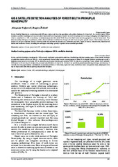
GIS & satellite detection analyses of forest belt in Prokuplje municipality
(Univ Osijek, Tech Fac, Slavonski Brod, 2016)
Corine Satellite Detection in combination with GIS may analyse and show the quantitive and qualitive features of a forest belt. As a result, it gives 100 m resolution satellite recordings and may even show horizontal forest ...
Design and implementation of WebGIS technologies in evaluation of erosion intensity in the municipality of NIS (Serbia)
(Springer, New York, 2016)
This paper studies the estimated losses of soil by water erosion in the municipality of Nis ( Serbia). The assessment of losses is determined by USLE method integrated with GIS technology, which provides a simple and fast ...

Implementacija GIS-a u turistički razvoj zaštićenih područja Toplice
(Beograd : Asocijacija prostornih planera SrbijeBeograd : Univerzitet u Beogradu - Geografski fakultet, 2023)
Turizam je postao važna privredna grana-povećava rast bruto domaćeg proizvoda, izvoz i zaposlenost. Kao heterogena delatnost ima uticaj i na srodne privredne delatnosti-poljoprivredu,trgovinu, građevinarstvo, saobraćaj ...
Assessment of soil erosion potential by the usle method: case study, Republic of Srpska - BiH
(Parlar Scientific Publications (P S P), 2011)
Soil erosion is a global problem, with severe consequences for the environment, human society and economy. In most cases, this process is caused by natural forces, but some human activities also contribute to soil erosion. ...