
Претраживање
Приказ резултата 1-10 од 24
Spatial analysis and mapping of fire risk zones and vulnerability assessment: Case study Mt. Stara planina
(Beograd : Srpska akademija nauka i umetnosti SANU - Geografski institut "Jovan Cvijić", 2013)
During the turn of the century, the current data of registered fires in Stara planina were insufficient to up date and incomplete, which directly conditioned unintended purpose of prevention and fire protection. With the ...
Application of the geodiversity index for the assessment of geodiversity in urban areas: an example of the Belgrade city area, Serbia
(Croatian Geological Survey, Zagreb, 2016)
Considering the fact that urbanization is one of the most serious threats to geodiversity, it is important that this issue is taken into account in spatial development plans and georesource management strategies in urban ...
New media in teaching of geography: Literature review
(Beograd : Srpsko geografsko društvo, 2015)
This paper provides an overview of published scientific papers in refereed journals on the use of new media in teaching geography. Relevant previous research on the application of GIS in the process of teaching at the ...
GIS methods and analysis of archaeological layers in the Toplica district (Serbia)
(Beograd : Srpska akademija nauka i umetnosti SANU - Geografski institut "Jovan Cvijić", 2019)
In this paper, we are explaining a decade long investigation of historical, sacral and archaeological sites in the Toplica District (Serbia) as one of the significant cultural heritage sites in Europe with more than 226 ...
Geoecological evaluation of Novi sad and environment for the purposes of health tourism and recreation
(Bijeljina : Technical Institute Bijeljina, 2017)
Novi Sad and its surroundings are rich with the most diverse natural values that are good for the development of health tourism and recreation activities on their territory. Being in nature, next to water surfaces, forests ...
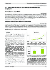
GIS & satellite detection analyses of forest belt in Prokuplje municipality
(Univ Osijek, Tech Fac, Slavonski Brod, 2016)
Corine Satellite Detection in combination with GIS may analyse and show the quantitive and qualitive features of a forest belt. As a result, it gives 100 m resolution satellite recordings and may even show horizontal forest ...

Značaj standardizacije geografskih informacija u istraživanjima medicinske geografije
(Beograd : Asocijacija prostornih planera SrbijeBeograd : Univerzitet u Beogradu - Geografski fakultet, 2019)
Medicinska geografija, kao naučna disciplina koja se bavi proučavanjem geografske sredine na zdravlje ljudi u tesnoj je vezi sa geografskim informacijama. Pravilno uređene geografske informacije, kao integrisani deo GIS-a, ...
Geoecological evaluation of Belgrade and environment for the purposes of rest and recreation
(Bijeljina : Technical Institute Bijeljina, 2016)
With this work we want to affirm geoecological evaluation, planning and landscape management. Geoecological evaluation of the Belgrade region, for the purpose of rest and recreation, was performed with quantitative method ...
Application of multi-criteria analysis and GIS in ecotourism development (Case study: Serbian Danube region)
(Beograd : Srpsko geografsko društvo, 2015)
Ecotourism can be defined as responsible travel to natural areas that conserves the environment and cultural heritage and improves the well-being of local people. Sustainable planning and management of ecotourism development ...
Multi-criteria GIS analysis of the topography of the Moon and better solutions for potential landing
(Sciendo, Warsaw, 2019)
During the past twenty years, the need to reach the Moon by the private space missions has been growing. Some of the private missions are supported by Google Lunar X-prize and Space-X. In the period between 2020 and 2050 ...