
Pretraživanje
Prikaz rezultata 11-20 od 51
GIS applications in physical planing a theoretical approach / Teorijski pristup primeni GIS-a u prostornom planiranju
(Beograd : Srpsko geografsko društvo, 1995)
GIS technology has application potential for a wide range of physical planning issues, including policy formulation, implementation, resource management and environmental impact assessment monitoring. This article briefly ...
GIS methods and analysis of archaeological layers in the Toplica district (Serbia)
(Beograd : Srpska akademija nauka i umetnosti SANU - Geografski institut "Jovan Cvijić", 2019)
In this paper, we are explaining a decade long investigation of historical, sacral and archaeological sites in the Toplica District (Serbia) as one of the significant cultural heritage sites in Europe with more than 226 ...
Design and implementation of WebGIS technologies in evaluation of erosion intensity in the municipality of NIS (Serbia)
(Springer, New York, 2016)
This paper studies the estimated losses of soil by water erosion in the municipality of Nis ( Serbia). The assessment of losses is determined by USLE method integrated with GIS technology, which provides a simple and fast ...
Assessment of soil erosion potential by the usle method: case study, Republic of Srpska - BiH
(Parlar Scientific Publications (P S P), 2011)
Soil erosion is a global problem, with severe consequences for the environment, human society and economy. In most cases, this process is caused by natural forces, but some human activities also contribute to soil erosion. ...
Geoecological evaluation of Novi sad and environment for the purposes of health tourism and recreation
(Bijeljina : Technical Institute Bijeljina, 2017)
Novi Sad and its surroundings are rich with the most diverse natural values that are good for the development of health tourism and recreation activities on their territory. Being in nature, next to water surfaces, forests ...
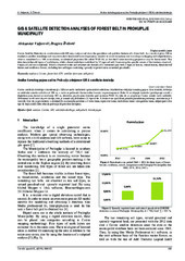
GIS & satellite detection analyses of forest belt in Prokuplje municipality
(Univ Osijek, Tech Fac, Slavonski Brod, 2016)
Corine Satellite Detection in combination with GIS may analyse and show the quantitive and qualitive features of a forest belt. As a result, it gives 100 m resolution satellite recordings and may even show horizontal forest ...
Geoecological evaluation of Belgrade and environment for the purposes of rest and recreation
(Bijeljina : Technical Institute Bijeljina, 2016)
With this work we want to affirm geoecological evaluation, planning and landscape management. Geoecological evaluation of the Belgrade region, for the purpose of rest and recreation, was performed with quantitative method ...
Urban Development Consequences on the Wetland Ecosystems Transformations-Case Study: Pancevacki Rit, Serbia
(Maik Nauka/Interperiodica/Springer, New York, 2018)
The article analyzes the consequences of one century long human influences on vegetation of the wetland ecosystem, on the example of Pancevacki Rit in Belgrade, Serbia. The autochthonous, non-altered ecosystem was formed ...
Geoinformation network for the purpose of the nature protection / Geoinformaciona mreža za potrebe zaštite prirode
(Beograd : Univerzitet u Beogradu - Geografski fakultet, 2007)
A recent global advance in moving from paper to digital data has created undreamed opportunities of access to data, communication of information and for informed decision-making at all levels of society. This so called ...
Assessment of soil erosion potential using rusle and GIS: a case study of Bosnia and Herzegovina
(Parlar Scientific Publications (P S P), 2013)
Soil erosion is a significant environmental problem that causes severe consequences on the human society and economy. The Integrated Revised Universal Soil Loss Equation (RUSLE) with the Geographic Information System (GIS) ...